- Available in early March
Pix4D & Emlid Scanning kit Standard
$3,990 tax excl.
Description
Mobile terrestrial scanning solution with RTK accuracy
Integrated Emlid and Pix4D solution to get digital model in minutes with survey-grade accuracy. Scan your assets with your mobile phone, store online, annotate, measure and share with your stakeholders. Verify geolocated positions and visualize the project in Augmented Reality.
Package includes
Software*
- PIX4Dcatch
- PIX4Dcloud
- PIX4Dcatch training
*1 year license keys will be sent separately via email after order confirmation.
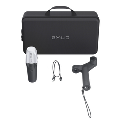
Hardware
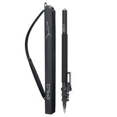
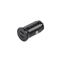
1. Reach RX receiver
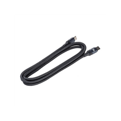
- Type-C cable
2. Emlid Scanning kit
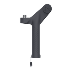
- Emlid handle
- Leash
- Allen key 3 mm
- Tags (5 pcs)
- Carrying case
Shipping
Shipping from Chicago
2-3 days by USPS priority, 2 - 7 days
by FedEx or UPS
Specifications
Specification
-
Mechanical
Package: In plastic case
Kit dimensions: 425 x 324 x 124 mm
Kit weight (with RX and plastic case): 4300 g (9.48 lb)
Bottom thread: 5/8”-11 UNC
Handle material: Polyamide 12
Handle weight: 175 g (0.38 lb)
Handle dimensions: 200 x 119 x 36 mm
-
Сompatibility
- Phone cases compatible with SPC+ SP connect.
- Handle can be adopted for right and left hand usage.
- SP connect case should be purchased separately.
Comes with software
for the field and the office
Emlid Flow efficiently manages all field-related tasks, including receiver configuration, RINEX logging, data collection, and stakeout.
The basic features are available for free to all users. Upgrade your Emlid Flow and Flow 360 with a single subscription.
You can access your survey data via the cloud-based Emlid Flow 360. It allows you to prepare, manage, and export your projects from a browser.
The basic features are available for free to all users. Upgrade your Emlid Flow and Flow 360 with a single subscription.
Our free post-processing software for macOS and Windows.
Learn more about Emlid Studio here.
Connect up to 10 rovers to your base station via the internet or set up your own NTRIP network with Emlid Caster.
Learn more about Emlid Caster here.
FAQ
Reach RX receives corrections from an RTK network or base and calculates centimeter-accurate coordinates (1 cm ≈ 0.39 in.), which are assigned to each image captured by your iPhone using the PIX4Dcatch mobile application. During image acquisition, the iPhone's LiDAR gathers point clouds. These LiDAR points compensate for the lack of 3D data over reflective or low-texture surfaces and help identify uncovered areas to fill gaps during scanning.
Once the project is complete, the captured data is sent to the PIX4D cloud for automatic processing. There, you can generate precise 3D reconstructions for further analysis or export to third-party software. Explore this example project to see the results in action.
• Reach RX
• Emlid Scanning Handle
• Tags (5 pcs)
• Type-C cable
• Leash
• Allen key 3 mm
• Carrying case
Standard kit includes:
• PIX4Dcatch - 1 year license
• PIX4Dcloud - 1 year license
• PIX4Dcatch training
Advanced kit includes everything Standard, plus:
• PIX4Dcloud Advanced - 1 year license
• PIX4Dmatic - 1 year license
• PIX4Dsurvey - 1 year license
What is not included:
• Smartphone
• SP-connect case
To ensure high accuracy indoors, ground control marks are essential. These GCPs must be georeferenced with centimeter (sub-inch) accuracy, which is not possible with RTK technology in indoor environments due to the lack of satellite signals. For this purpose, classic geodetic techniques, such as surveying with a total station, are recommended.