


Reach RS4 Drone Base Station Kit
The perfect base for your RTK or PPK drone
Compatibility
Works with any RTK drone that accepts NTRIP corrections in RTCM3 format. This includes DJI, Wingtra, Autel, Skydio and many more.
Emlid Corrections
To achieve centimeter-level (sub-inch) accuracy with RTK, you need a source of corrections — positioning enhancement data that upgrades standard GNSS accuracy from meters to centimeters in real time.
Your receiver includes one free year of Emlid Corrections — a built-in network service to receive corrections over the internet. Learn more and check coverage in your area.
Free Emlid NTRIP Caster
Use our free caster to pass corrections between the Reach RS4 base station and your drone.
Local NTRIP Caster feature
This setup still works if there is no internet coverage on a site.
RINEX
Log raw data for PPK in an industry-standard format.
Explore all Reach RS4 features and user reviews
Package includes
- Reach RS4
- Carrying case
- USB Type-C cable
- LoRa Antenna 860-930 MHz
- UHF Antenna 410-470 MHz
- Quick release adapter
- Reach RS4 Bumper
- Extension Pole
- Base Accessories Kit:
- Seco aluminum tripod
- Seco tribrach with optical plummet
- Seco rotating tribrach adapter
Shipping from Chicago
2-7 days by FedEx or UPS



Your first year of RTK corrections is included
Emlid Corrections is built into your receiver. No base station, no NTRIP setup — just open Emlid Flow, tap Emlid Corrections, and get centimeter accuracy in seconds.
Love it from day one? Lock-in 3 years of savings:
Not satisfied? Full refund, no questions asked.
Coverage
Emlid Corrections is available in the United States, the UK, Europe, Australia, and New Zealand.
Not in your region yet?
Subscribe to our newsletter and be the first to know when we expand.
Which Receiver Is Right for You?
| Feature | 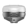 Reach RS4 Pro Reach RS4 Pro |  Reach RS4 Reach RS4 | 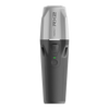 Reach RX2 Reach RX2 | 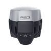 Reach RS3 Reach RS3 |
|---|---|---|---|---|
| Price | $4,599.00 | $3,899.00 | $2,399.00 | $2,999.00 |
|
Best for |
Large-scale construction, civil engineering and mining on complex, limited-access or hazardous sites |
Topo, residential construction and drone mapping across rugged, forested and urban sites |
Utility construction, GIS, asset mapping and mobile scanning — the lightest Reach, wherever mobile coverage reaches |
Individual surveyors and small businesses working mixed, largely open sites |
|
RTK accuracy |
7 mm + 1 ppm |
7 mm + 1 ppm |
7 mm + 1 ppm |
7 mm + 1 ppm |
|
Satellite tracking |
672 ch |
672 ch |
672 ch |
184 ch |
|
Tilt compensation |
Unlimited angle |
Unlimited angle |
Unlimited angle |
Up to 60° |
|
AR stakeout |
||||
|
Visual capture |
||||
|
Setup |
Base + Rover |
Base + Rover |
Rover only |
Base + Rover |
|
Radio |
LoRa up to 1 W |
LoRa up to 1 W |
LoRa 0.1 W |
|
|
RINEX logging |
||||
|
IP rating |
IP68 |
IP68 |
IP68 |
IP67 |
|
Battery life |
16 h |
16 h |
16 h |
18 h |
|
Weight |
943 g |
927 g |
280 g |
950 g |
Comes With Software for the Field and the Office
The Emlid Flow mobile app efficiently manages all field-related tasks, including receiver configuration, RINEX logging, data collection, and stakeout. In its web version—Emlid Flow 360—you can prepare and manage projects, and quickly export and share your data.

The basic features are available for free to all users. Upgrade your Emlid Flow and Flow 360 with a single subscription.
 Tilt Compensation
Base and rover setup
Coding
Points, lines, and polygons
Inverse & Traverse
WMS layers
DTM support
Stakeout reports
CSV, DXF, SHP, and KML
Tilt Compensation
Base and rover setup
Coding
Points, lines, and polygons
Inverse & Traverse
WMS layers
DTM support
Stakeout reports
CSV, DXF, SHP, and KML