


Septic system mapping, Property lines,
"Septic system mapping, Property lines, utility locations"
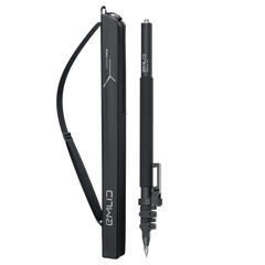
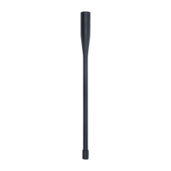
Survey Pole with a smartphone mount
$349
Survey grade precision even in hard-to-reach spots. Acts as a base or rover. Comes with a mobile app.
6DOF, RTK + 2 mm + 0.3 mm/°
Calibration-free and immune to magnetic disturbances
GPS/QZSS L1C/A, L2C,
GLONASS L1OF, L2OF,
BeiDou B1I, B2I,
Galileo E1-B/C, E5b
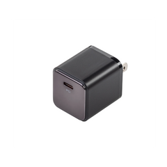
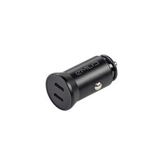
Li-Ion battery, USB Type-C charging
To connect the device to the internet
868/915 MHz LoRa to receive and transmit corrections
450 MHz UHF to receive corrections from bases transmitting TRIMTALK 450S (trademark of Trimble Inc.)
Supported protocols to send and receive corrections
Explore all Reach RS3 features and user reviews
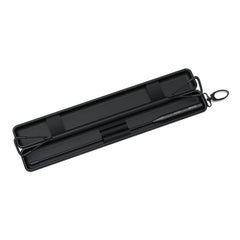
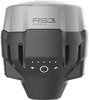
– Reach RS3
– Carrying case with a strap
– Radio antenna
– USB Type-C cable
2-7 days by FedEx or UPS
Specification
Dimensions: 126 x 126 x 142 mm
Weight: 950 g
Operating tº: -20 to +65 ºC
Ingress protection: IP67
Autonomy: 18 hrs as RTK rover with tilt, 22 hrs of logging
Battery: Li-Ion 5200 mAh, 7.2 V, 37.44 Wh
External power input: 7.2 V
Charging: USB Type-C 5 V, 3 A
Certification: FCC, CE
Static: H: 4 mm + 0.5 ppm | V: 8 mm + 1 ppm
PPK: H: 5 mm + 0.5 ppm | V: 10 mm + 1 ppm
RTK: H: 7 mm + 1 ppm | V: 14 mm + 1 ppm
Tilt compensation: RTK + 2 mm + 0.3 mm/°
Convergence time: ~5 s typically
LoRa radio
Frequency range: 868/915 MHz
Power: 0.1 W
Distance: Up to 8 km
UHF radio—receive only*
Frequency range: 410 - 470 MHz
Protocols: TRIMTALK 450S**
Modulation type: GMSK
LTE modem
Regions: Global
Bands: FDD-LTE: 1,2,3,4,5,7, 8, 12, 13, 18, 19, 20, 26, 28, 66 TD-LTE: 38,40,41
UMTS (WCDMA/FDD): 1,3,2,4,5,6, 8,19 Quad-band, 850/1900, 900/1800 MHz
SIM card: Nano-SIM
Wi-Fi: 802.11 b/g/n
Bluetooth: 5.4
Ports: RS-232, USB Type-C
*Requires a 410-470 MHz antenna, sold separately.
**TRIMTALK is a trademark of Trimble Inc.
Corrections: NTRIP, RTCM3
Position output: NMEA, LLH/XYZ
Data logging: RINEX, NMEA, LLH/XYZ, UBX
Internal storage: 16 GB
Signal tracked: GPS/QZSS L1C/A, L2C GLONASS L1OF, L2OF BeiDou B1I, B2I Galileo E1-B/C, E5b
Number of channels: 184
Update rates: up to 10 Hz
IMU: 6DOF

Precision
RTK
H: 7 mm + 1 ppm
V: 14 mm + 1 ppm
PPK
H: 5 mm + 0.5 ppm
V: 10 mm + 1 ppm
RTK
H: 7 mm + 1 ppm
V: 14 mm + 1 ppm
PPK
H: 5 mm + 0.5 ppm
V: 10 mm + 1 ppm
RTK
H: 7 mm + 1 ppm
V: 14 mm +1 ppm
Tilt compensation
RTK + 2mm + 0.3mm/°
RTK + 2mm + 0.3mm/°
RTK + 2 mm + 0.3 mm/°
Base mode
✔︎
✔︎
—
Data logging
✔︎
✔︎
—
Connectivity
UHF radio (receive-only),
LoRa radio (send or
receive), NTRIP, Serial,
TCP, Bluetooth
UHF radio,
LoRa radio (send or
receive), NTRIP, Serial,
TCP, Bluetooth
NTRIP via Bluetooth from
a smartphone/tablet
Battery life
18 hrs as RTK rover with
tilt, 22 hrs of logging
16 hrs as LTE RTK rover
16 hrs
Weight
950 g
920 g
280 g
Ingress protection
IP67
IP68
IP68
The Emlid Flow mobile app efficiently manages all field-related tasks, including receiver configuration, RINEX logging, data collection, and stakeout. In its web version—Emlid Flow 360—you can prepare and manage projects, and quickly export and share your data.

The basic features are available for free to all users. Upgrade your Emlid Flow and Flow 360 with a single subscription.
 Tilt Compensation
Base and rover setup
Coding
Points, lines, and polygons
Inverse & Traverse
WMS layers
DTM support
Stakeout reports
CSV, DXF, SHP, and KML
Tilt Compensation
Base and rover setup
Coding
Points, lines, and polygons
Inverse & Traverse
WMS layers
DTM support
Stakeout reports
CSV, DXF, SHP, and KML