


- SELLING FAST – ORDER TODAY!
Reach RX
$2,199 tax excl.
Free shipping from Chicago (2-7 days)
Often Bought Together
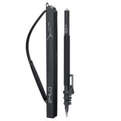
Survey Pole with a smartphone mount
$349
Lightweight and easy-to-use multi-band RTK GNSS receiver
Designed specifically for work with NTRIP corrections.
Comes with a mobile app.
GNSS
GPS/QZSS L1C/A, L2C,
GLONASS L1OF, L2OF,
BeiDou B1I, B2I,
Galileo E1-B/C, E5b
250 g
Compact and lightweight
16 hrs
Li-Ion battery, USB Type-C charging
Communication interface
Bluetooth 4.2, MFi-certified
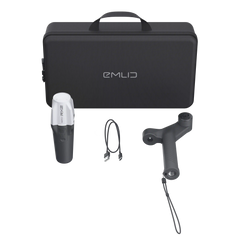
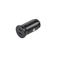
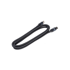
Package includes
– Reach RX
– USB Type-C cable
Shipping from Chicago
2-7 days by FedEx or UPS
Specifications
-
- SHIPPING IN LATE DECEMBER
![Reach RS4]()
![Reach RS4]()
-
- SHIPPING IN LATE DECEMBER
![Quick Release Adapter]()
![Quick Release Adapter]()
-
- Pre-order
![Emlid Scanning kit]()
![Emlid Scanning kit]()


Specifications
-
Mechanical
Dimensions: 172 x 51 x 51 mm
Mount: 5/8”-11 UNC
Weight: 250 g (8.81 oz)
Operating tº: -20 to +65 ºC
Ingress protection: IP68 (maximum depth of 1.5 meters up to 30 minutes)
-
Electrical
Autonomy: Up to 16 hrs
Battery: Li-Ion 5200 mAh, 3.6V, 18.72 Wh
Charging: USB Type-C, 5V, 2A
Certification: FCC, CE, IC
-
Positioning
RTK: H: 7 mm + 1 ppm | V: 14 mm + 1 ppm
Convergence time: ~5 s typically
-
Connectivity
Communication interface: Bluetooth 4.2 (BR/EDR + LE)
Ports: USB Type-C
-
Data
Input data format: RTCM3
Input data protocol: NTRIP
Position data format: NMEA
-
GNSS
Signal tracked: GPS/QZSS L1C/A, L2C GLONASS L1OF, L2OF BeiDou B1I, B2I Galileo E1-B/C, E5b
Number of channels: 184
Update rates: 5 Hz
Comes With Software for the Field and the Office
The Emlid Flow mobile app efficiently manages all field-related tasks, including receiver configuration, RINEX logging, data collection, and stakeout. In its web version—Emlid Flow 360—you can prepare and manage projects, and quickly export and share your data.

The basic features are available for free to all users. Upgrade your Emlid Flow and Flow 360 with a single subscription.
 Tilt Compensation
Base and rover setup
Coding
Points, lines, and polygons
Inverse & Traverse
WMS layers
DTM support
Stakeout reports
CSV, DXF, SHP, and KML
Tilt Compensation
Base and rover setup
Coding
Points, lines, and polygons
Inverse & Traverse
WMS layers
DTM support
Stakeout reports
CSV, DXF, SHP, and KML